Draft Basic Assessment Report: Proposed New Regional Cemetery on Portion 33 of the Farm Hill View NO. 437, Plettenberg Bay, Western Cape
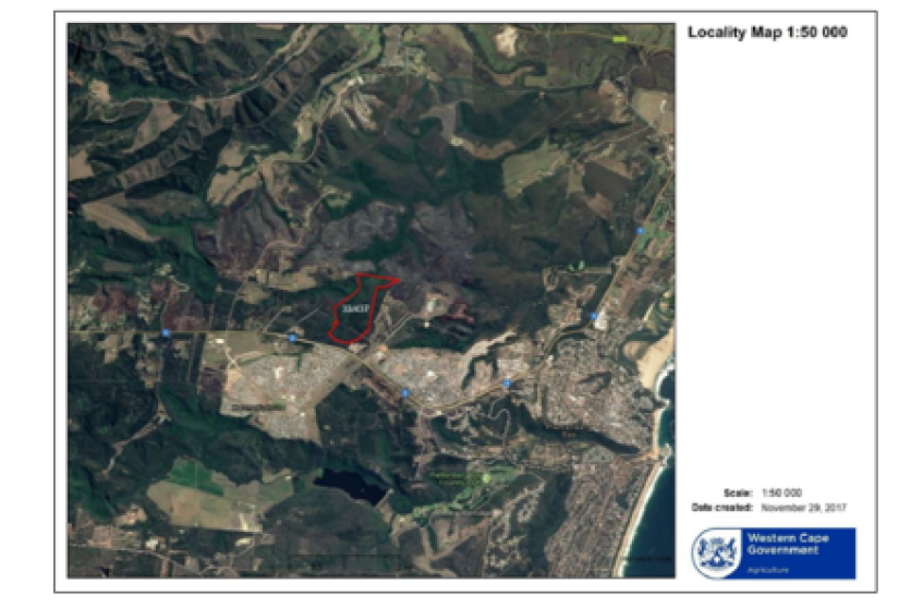
Five properties were initially identified by the Bitou Municipality for the proposed development of a regional cemetery. After several specialist studies were conducted on each property, Portion 33 of the farm 437 Hillview was identified as the most viable option. Portion 33 of the farm Hillview 437 is located to the north of the Kwanokuthula suburb and west of Plettenberg Bay town. The site can be located at GPS coordinates 34° 2'28.31"S and 23°19'48.95"E.
Alternative 1 (Preferred Alternative) – 44.976ha total area; approximately 12ha development footprint: The preferred alternative includes the following:
• Regional cemetery
• Memorial garden
• Chapel – 250m2
• 51 Public parking bays and 3 bus parking bays
• Ablution block – 30m2
• Caretakers dwelling – 75m2
• Access road
• Private Open Space – 33ha. *Potential future plans - The private open space will be used for recreational purposes such as hiking and biking trails that can contribute to tourist development.
The cemetery will be split into a northern (approx. 3.67ha) and southern (approx. 6ha) section by the access road. The graves on the northern section will total 4239 (3619 adult graves and 620 children’s graves) and the graves on the southern section will total 6142 - no children’s graves will be located on the southern section of the cemetery. The adult graves will measure 2.2m x 0.9m with a spacing of 1.2m between each grave. Children’s graves measure 1.5m x 0.7m with a spacing of 1.2m between each grave. A 22m electrical servitude traverses the southern part of the proposed cemetery and no graves will be located within this servitude.