FINAL Basic Assessment Report - Proposed Development of a Deck and Boardwalk Within 100 Meters Inland of the High-Water Mark of the Sea, Erf 9706, Plettenberg Bay, Western Cape DEA&DP REF: 16/3/3/1/D1/15/0005/26
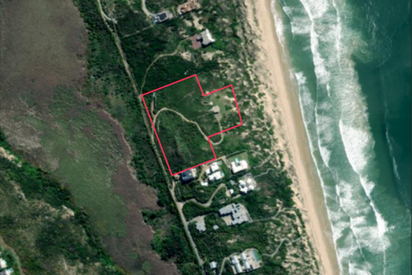
Erf 9706, Plettenberg Bay, Western Cape Province.
Erf Nr: 9706 (34.091161°S 23.370694°E)
Area (Sqm): 23228.3
SG Code: C03900080000970600000
SG Region: KNYSNA
Minor Region: PLETTENBERG BAY
The property is zoned Residential. The owner is applying for the development of a deck and boardwalk within 100 meters inland of the High-Water Mark of the sea, Erf 9706, Plettenberg Bay, Western Cape.
Preferred Alternative/ Alternative 1:
This alternative will now consist of the construction of a timber deck and boardwalk that will terminate within the applicant’s property boundary. The boardwalk was previously existing and originally extended beyond the property boundary into State-Owned land (see below figure 1). This was assessed in the previous Draft Basic Assessment Report/ BAR but has since been revised to align with the recommendations of various organs of state, hence this revised report. The biodiversity assessment was commissioned to assess the entire existing boardwalk area within the boundary of Erf 9706 and within the State-Owned land. There is only a minor portion – 20.5m2 of the proposed boardwalk that will follow a new route before terminating at the property boundary.